Mount Changbai
The crater fell in, filled with water, and the surface now sits at two thousand metres inside sixteen stone peaks.
Mount Changbai stands in south-east Jilin, on the border with North Korea, and is the highest ground in the north-east. The summit is a compound volcano whose top collapsed into a caldera, and the caldera holds a lake. The water surface is at 2,189 metres and the deepest point is 373. The sixteen peaks around it are the rim.
- Region
- Jilin · Baishan
- Lake surface
- 2,189 m
- Depth
- 373 m
- Surface area
- About 9.8 km²
- Last eruption
- 1702
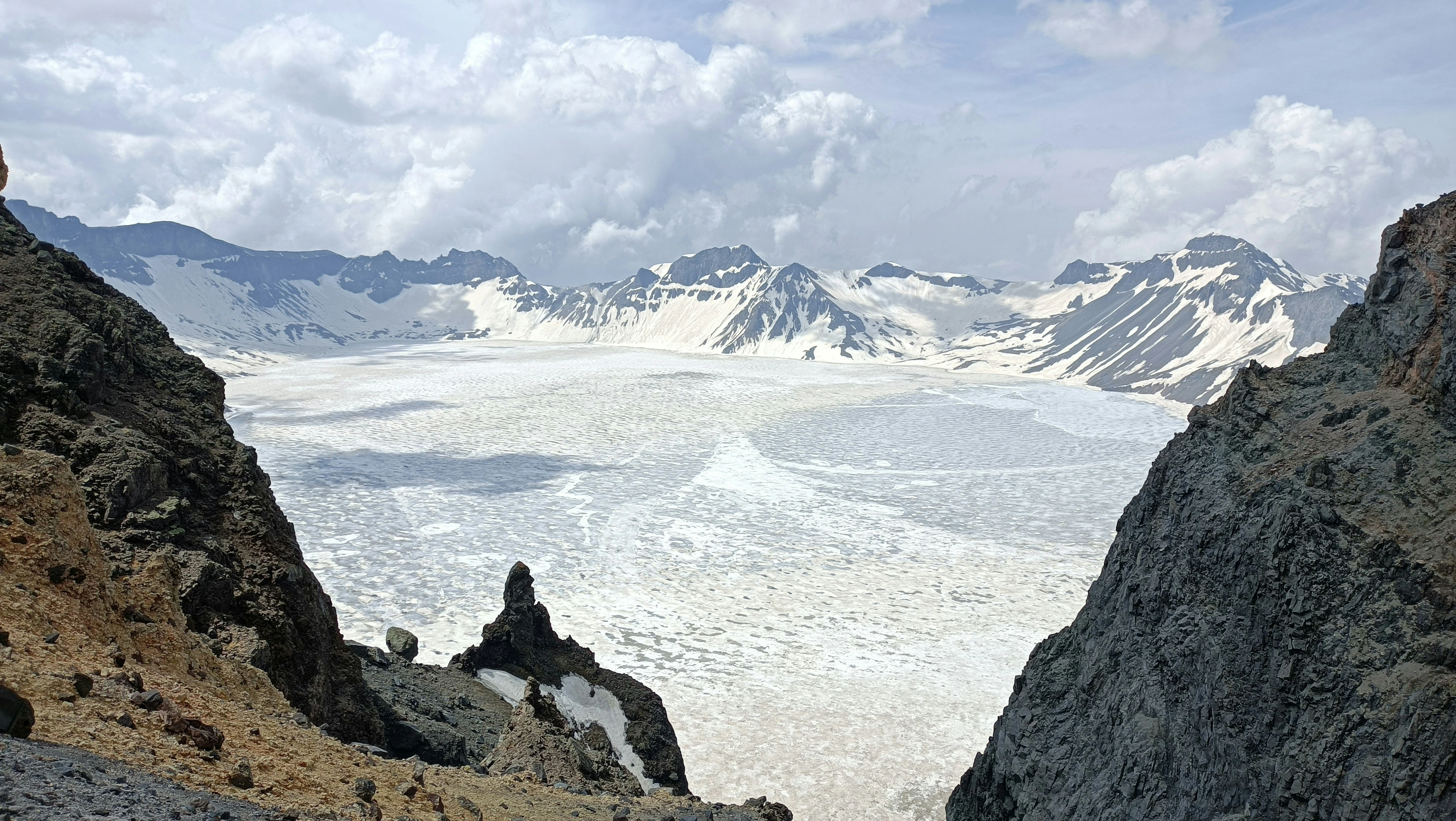
In 946 this mountain erupted. It threw out pumice and ash over several hundred li, the top of the cone lost its support and dropped in along ring fractures, and the caldera filled with rain and meltwater. The volcano is not dead. Heat is still down there, which is what the hot springs and steaming ground at the foot are evidence of.
Tianchi
2,189 metres above sea level, sixteen peaks around it, one outlet at the north.
Changbai Falls
The lake drains through that notch and drops 68 metres over basalt.
Julong springs
The water comes out close to boiling and stains the rock it crosses yellow-brown and rust.
It is narrow, cloud comes through it, and the lake is there and then not there.
The summit came down
An ordinary crater is a hole blown out by an eruption, and it is shallow, a few tens of metres. This is not a hole. In 946 the magma chamber emptied, the summit lost its support, and a block several kilometres across sank along ring fractures. The basin that left is what the water fills, and its floor was already low before any rain arrived, which is how 373 metres accumulates. The sixteen peaks are the edge of that break.
The ash from that eruption fell as far as northern Japan. The volcano is not finished. The springs and steaming ground at the foot are heat still coming up.
A stone from the shore floats, at first
Pick up a stone at the lake edge and it is far lighter than it looks, a hard sponge. That is pumice. Bubbles in the magma did not escape before it cooled, the holes stayed, and enough holes make a rock lighter than water. Thrown in, it floats, then takes water and goes down.
The holes in the rock face show direction as well. Elongated bubbles line up the way the material was moving, which is how something now solid shows that it once flowed.
Cloud comes through the notch
The lake sits above 2,000 metres and the cloud runs at that height. The notch on the north side is narrow; cloud pours through it and the lake is gone in minutes, then the wind clears it again. Not many days in the year have the whole surface open, and arriving early does not decide it.
Wind up here carries ice, so a jacket is needed in summer too. The last stretch is a steep flight of steps with the height gained fast, walked in stages.
Since the 2000s private cars stop at the gate. Shuttle buses go up, then a boardwalk leads down to the rim.