Longji Terraces
Water comes off the summit and steps down, one level at a time, across the whole face of the mountain.
Longji lies on the Yuecheng range in Longsheng, with Zhuang and Yao villages scattered among the terraces. The slope is steep, the soil thin and the rain plentiful, so the hillside was cut into level fields and spring water was led down to them in split bamboo. The fields step; the water runs all the way.
- Region
- Guangxi · Guilin
- Elevation
- 300-1,100 m
- Plot width
- The narrowest are a metre or two, a few rows of seedlings
- Irrigation
- Gravity: water spills from the top plot down
- Listed
- 2018, Globally Important Agricultural Heritage System
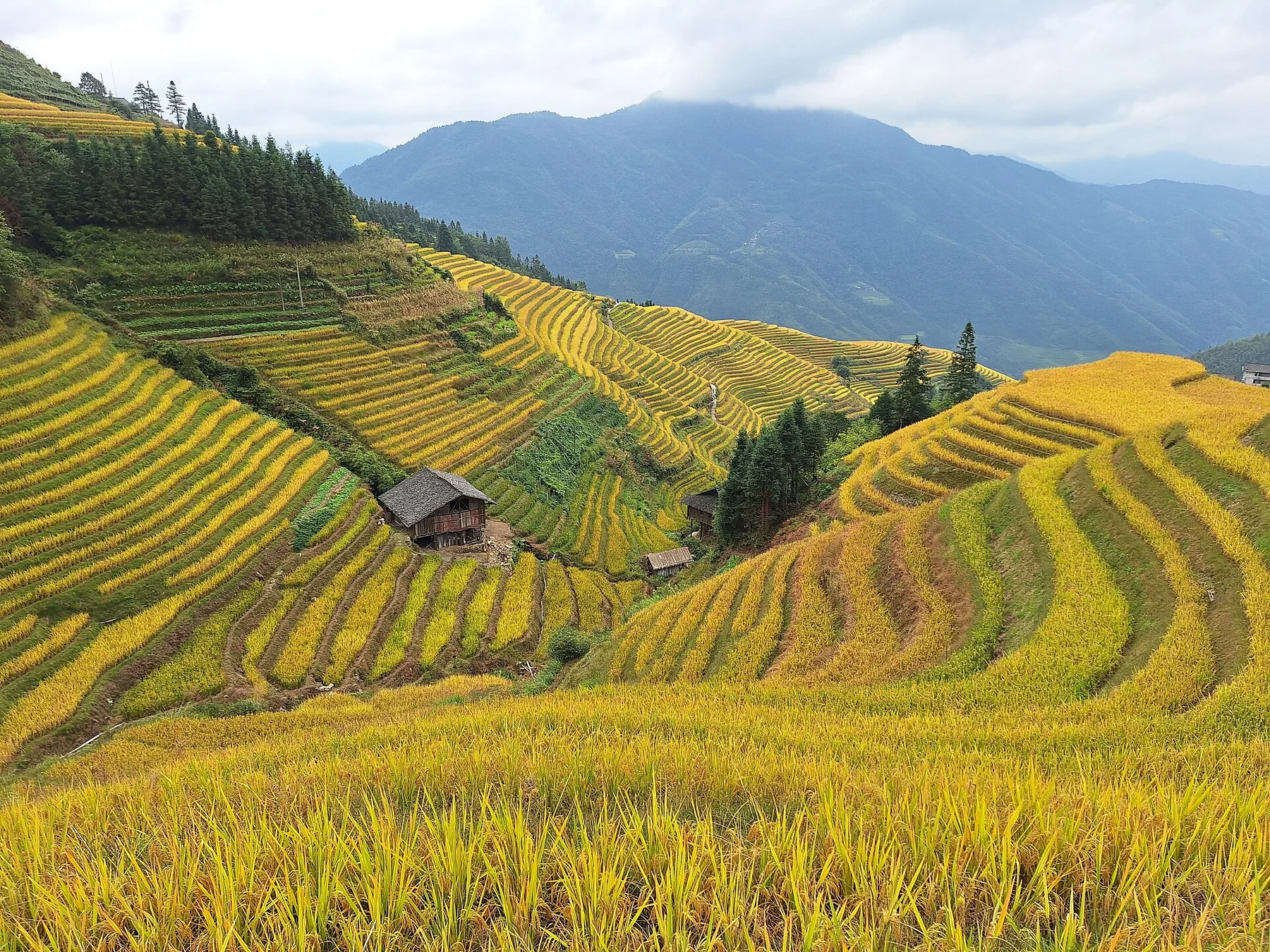
On a steep slope with thin soil there is no choice but to plough along the contours. Rain here is heavy and reliable all year, so spring water can be led by gravity rather than lifted. Paddies therefore stack from the foot of the hill to the waist of it as one continuous stair of water. The terracing was opened gradually between the Yuan and the early Qing.
The contours
Every bund is a contour line, and the width of a field is set by the gradient.
Bamboo flumes
Split culms laid end to end carry water from a spring to the highest field.
The dividing log
A notched log at the outlet, its slots cut to each household's share.
The fields have just been filled, light sits on every level, and the whole mountain turns bright.
A bund is a contour line
A field on a slope has to be level, or the water will not stay. So the back of every terrace is cut into the hill and the front is built up until the surface is flat. Where the hill is steep the contours run close together and a terrace is one or two metres wide, holding a few rows of seedlings; where it eases, a field opens to fifteen metres. The widths change all the way up, which is the slope spelling itself out.
The floor has to hold water too. Centuries of ploughing have pressed a dense pan just under the surface, and water does not go through it. There is no soil to bring up here. That pan is what keeps the hill in rice.
Each bund carries a gap
Water enters the top field from a spring, spills through a gap in the bund into the next when the field is full, and steps down to the stream. The gap is not cut at random: whichever side it sits on is the side the water goes, and a stone is set beneath it so the water does not bore a hole through the bund. The water route for a whole mountainside is a string of gaps.
Split bamboo carries water from a distant spring to the highest field, lengths joined end to end and sealed with mud. Where a channel is shared, a log is fixed across the outlet with slots cut to different widths, one per household, and the water divides by slot width. The slots are cut once and left.
For a few days the whole mountain is bright
In the days when a field is full and not yet planted, every terrace is a mirror with the sky lying on it, step after step down the slope. Once the seedlings go in the surface is covered, the mirrors are gone until the rice is tall enough to draw lines again.
When the rice turns, the bunds come out and the shape of the hill reads more clearly than it did under water. In mist only the lowest terraces exist and everything above is white. The viewpoints sit halfway up, reached from the villages by continuous stone steps with several hundred metres of climb in one go.
Someone has to keep the terraces up. Guesthouse income here now exceeds farming, the furthest plots, high on the slope, have gone wild, and a broken bund is nobody's job.