Yuanyang Terraces
More than three thousand flooded terraces on one slope, from below the ridge to the valley floor.
Yuanyang is in the southern Ailao Mountains of Yunnan, where the Red River has cut down more than a thousand metres. Slopes run between 25 and 50 degrees, and on the steepest the bund between two fields is no wider than a foot. The Hani cut fields along the contour, from the valley floor up to the forest on the ridge, with the villages in between.
- Region
- Yunnan · Honghe
- Elevation
- Up to 2,000 m
- Steps
- Up to 3,700 on a single slope
- Heritage core
- About 16,600 hectares
- Listed
- 2013, World Cultural Heritage
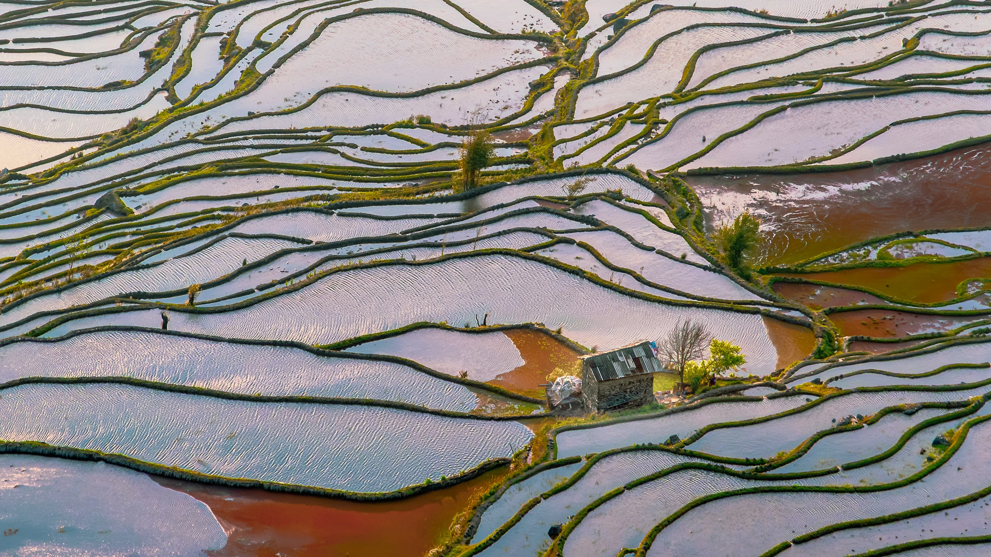
The windward slope catches warm wet air rising off the Red River. Rain falls in the evergreen forest on the ridge, and the springs that seep out below it run all year: the water is as high as the mountain. It travels down by gravity, is led into each terrace by a channel, and passes from one field to the next through a gap in the bund, ending in the river again. Forest above, village in the middle, fields below. That order is what makes rice possible on a slope.
Duoyishu
Several thousand fields packed onto one slope that faces east, with morning mist often stopped halfway up.
Bada
Over a thousand metres of fall, and the brightest reflection of the day at sunset.
Azheke
A village of mushroom houses, rammed earth walls and thatch, with a sacred grove at the entrance that may not be cut.
It faces east, so the first light lands on the topmost flooded field and then walks down, one terrace at a time.
The forest on the ridge is the reservoir
Water on this slope is not pumped up. It falls in the evergreen forest on the ridge, where leaf litter and moss hold it and let it down slowly, and what does not seep through becomes a spring that runs all year. Cut the forest and the springs drop that same year, and the fields are short of water the next.
So the order is fixed: forest at the top, villages in the middle, fields at the bottom. Water leaves the forest, runs sideways along the contour channels, enters the highest field, and passes down through the gaps in each bund to the Red River. Take one of the three away and the system stops.
Every field is fed through a stone mouth
The channel runs along the hillside and splits wherever there is a field. The split is built of stone with a square mouth, and how much water enters is set by the size of that mouth. Below it the water drops onto a slab, and the sound of it runs all year.
The water in the fields is cold and clear. A hand put in feels like a hand put in a well. It is not pond water; it has come down from the forest in shade the whole way.
A mushroom house is rammed earth, thick enough to stop the winter wind, with a four-sided thatch roof that sheds rain fast and a hearth on the upper floor whose smoke dries the beams on the way out. The grove at the head of the village is not cut. The reason is water, not luck.
The order in which the light lands
When the fields are full, a slope is several thousand mirrors, the sky lies on them, and only then does the lie of the hill show. At sunrise the first light takes the highest field and then steps down, and covering a whole slope takes time.
Cloud shadow moves across the fields, one patch bright and one dark, with a hard edge. When mist comes up from the river only the top few terraces exist and the rest is white, and mist goes as fast as it came.
Since the listing no new building is allowed in the core area. Young people leave and the furthest fields are being abandoned. Someone still walks the channels to open and close them, by the old rule.