Xiapu Mudflats
The tide goes out twice a day and leaves kilometres of seabed, with bamboo poles standing in the mud.
Xiapu is in north-east Fujian, on a coast that folds in and out. The tidal range is large, so at low water the sea withdraws for kilometres and leaves black mud, with channels cut through it like branches. Rows of bamboo poles stand in the mud, holding nets of laver.
- Region
- Fujian · Ningde
- Coastline
- 480 km
- Tide
- Semi-diurnal, spring range about six metres
- Mudflat
- 22,800 hectares of tidal flat
- Farming
- Kelp, laver, oysters
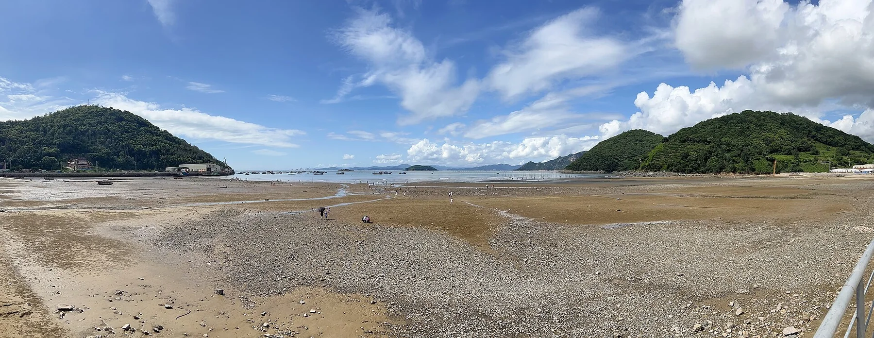
The rivers of eastern Fujian are short and steep and bring fine mud into the bays. Islands across the mouths cut the swell, so the mud settles instead of being stirred away, and thickens year on year. The range is large because this water sits in the East China Sea tidal system: semi-diurnal, rising and falling twice a day. When it falls, it goes quickly and exposes the whole flat.
Beicheng
A flat facing east. When the tide drops, water still runs in the channel, and the poles throw long shadows across the mud.
Xiaohao
A bay where sand and mud meet. On the ebb the water leaves a lattice of lines across the sand.
Dongbi
A village built on the cliff, with fish rafts and open sea below.
Below, the poles stand in the mud one by one, a channel runs through them, and water is already moving up it.
The mud stays because the bay mouth blocks the swell
The rivers of eastern Fujian are short and fast, and they bring the hills’ fine mud down with them. In the bay the water slows, the coarse drops first and the fine travels further. The bays sit one inside another with islands across their mouths, so swell does not get in, and what settles is not stirred up again. A layer a year.
The flat also builds itself upward. Fine mud carried in on the flood settles among algae and grass, a few millimetres a year. Once it stands above the high-water line, grass takes hold, the flat becomes salt marsh, and the edge of the farming moves out.
There is a water line across every net
At low water the whole system can be read. The poles are driven into the mud in rows at even spacing; the nets hang between them, and across each net runs a horizontal line, darker than the cloth above or below it. That line is where the tide stopped on its way out.
The surface is full of holes, crowded together: fiddler crabs and mudskippers. Water still runs in the creeks, and water is brighter than mud, so a creek is the brightest line on the flat and reads from a distance like the branch of a tree.
The neat rows are not for looks. Every net has to dry on time and wet on time for the laver to hold, and an installation lasts several years, so the cost sits in the poles and the rope.
The tide is later every day
Two rises and two falls, a bit over six hours apart, and the next day’s tide runs about fifty minutes later than the one before. Anyone wanting the water at its furthest out works from that table, not from the clock.
Light low, wet mud reflects and dry mud goes grey, and the flat gains its layers; with the sun high it is one even brown. In typhoon season the cloud moves fast, the light comes and goes, and rain arrives with no shelter on the flat.
As photographers arrived, villages built platforms at Beiqi and Yangjiaxi and began charging for parking and the climb.