Midu Glacier
The ice tongue comes down from the snow line and stops inside the forest, above a lake of grey water.
Midu lies in the eastern Nyainqêntanglha range, in Bomi. Most glacier tongues end on bare rock and scree; this one descends to around 2,400 metres and ends against conifer forest, with no bare zone between ice and trees.
- Region
- Tibet · Nyingchi
- Snout
- About 2,400 m
- Type
- Temperate glacier, fed by monsoon snow
- Location
- Yupu, Bomi County
- Terminus
- Two moraine lakes
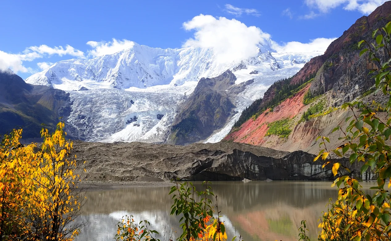
Moisture carried by the Indian monsoon accumulates as snow on the eastern slopes, compacts into ice, and moves down a steep valley. The valley faces north and stays in shadow for much of the day, which slows ablation enough for the ice to reach the forest belt. Where the bed steepens, the ice breaks into an icefall several hundred metres high.
The icefall
Ice breaks over a steep step and falls in a row of towers.
Lateral moraine
Long ridges of debris along both sides mark where the ice once reached.
Forest against ice
Conifers grow right up to the tongue, with no band of bare rock between.
The line where the ice tongue meets the forest is the one thing here worth looking at.
How low the ice can reach is an equation
Where a glacier ends depends on when supply runs out. Supply follows precipitation; melt follows temperature and sunlight. Midu’s precipitation is monsoon-fed, metres of snow in a season, and the valley faces north, so it spends most of the day in its own shade. Both terms push the same way: snow arrives in volume, less of it goes.
The third term is steepness. The valley is steep, the ice moves fast, tens of metres a year, and it arrives low down before it has had time to melt. All three together put the end at 2,400 metres, low enough to be standing among trees.
No gap between ice and forest
Most glaciers end on bare rock and rubble: moraine first, then a stretch of stone with nothing on it, then grass and trees. That stretch is missing here. Conifers grow to the edge of the tongue, a few metres between the crowns and the ice wall.
From the slope above the village three things stand in a row: white above, grey in the middle, green below. The grey is moraine, a long bank running down both sides of the valley and standing higher than the present ice. That bank is where the ice used to reach, and the distance from it to the ice now is what has gone.
Cloud comes over the valley mouth and the line goes
In sun the ice is grey-white and the blue sits only in the fractures, deepest on the walls of the crevasses and towers. When cloud comes in over the mouth of the valley, ice and sky are the same grey, and the white-green boundary is the first thing to go, leaving a grey with no depth in it.
The two lakes at the end are opaque. The glacier grinds rock underneath, the flour goes down with the water, and the lakes stay milky grey with no bottom showing. Their shores are fresh rubble with nothing growing on it yet.
Reaching the lake from the village means crossing that lateral moraine, where the rubble is loose and every step slides back half. The altitude is around 3,000 metres, and walking fast means stopping to breathe.
The tongue is retreating. The two lakes at its end are larger than they were decades ago, their shores fresh rubble with no grass on it yet.